This post is meant to be supplemental information for my video on YouTube highlighting this particular section of trail.
Notes for this video & section:
- All mile markers are from the 2015 AT Guide, but distances from one point to another within this section should be relatively the same each year. You can check out the AT Guide here: www.theatguide.com Also, the Guthook’s App is useful. Take a look at it here: http://www.guthookhikes.com/apps
- “Trail North” – means heading towards Katahdin on the trails instead of “Trail South” which is heading towards Springer Mountain. The trail obviously isn’t always pointed due North and it’s easier when on trail to make this distinction. Trail West simply means “to the left” if you are heading Trail North when you intersect another road and Trail East is to the right. I hope that isn’t too confusing. You will notice that the AT Guide is laid out this way.
- General Vicinity of Highlighted Section: About a third of the way up the AT near a town called Catawba, VA.
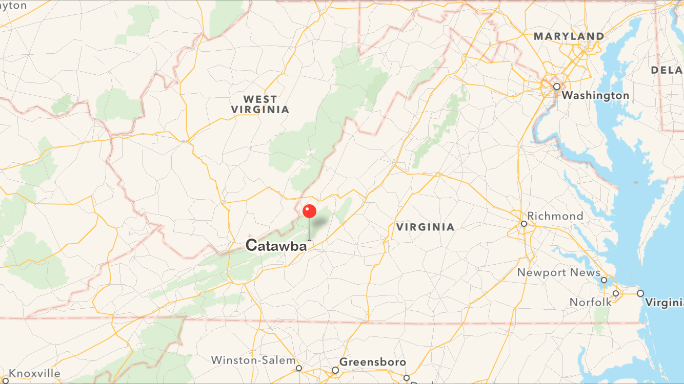
- Distance: 19.8 miles – 27.2 miles one-way (depending on your preference)
- There is also an opportunity for a 7.4 mile (round-trip) day hike – see maps below.
- Entrances/Exits (See Maps Below for More Detail):
-Mile 702.1: VA 624/Newport Rd. (No Parking) – Catawba, VA
-Mile 708.0: VA 311 (Parking Area) – Catawba, VA
(This is the entrance you would take for the 7.4 mile McAfee Knob day hike)
-Mile 727.8: US 220 (No Parking) – Daleville, VA
-Mile 729.3: US 11 (Parking Area) – Troutville, VA
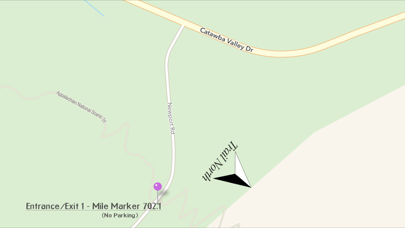
First Entrance (No Parking)
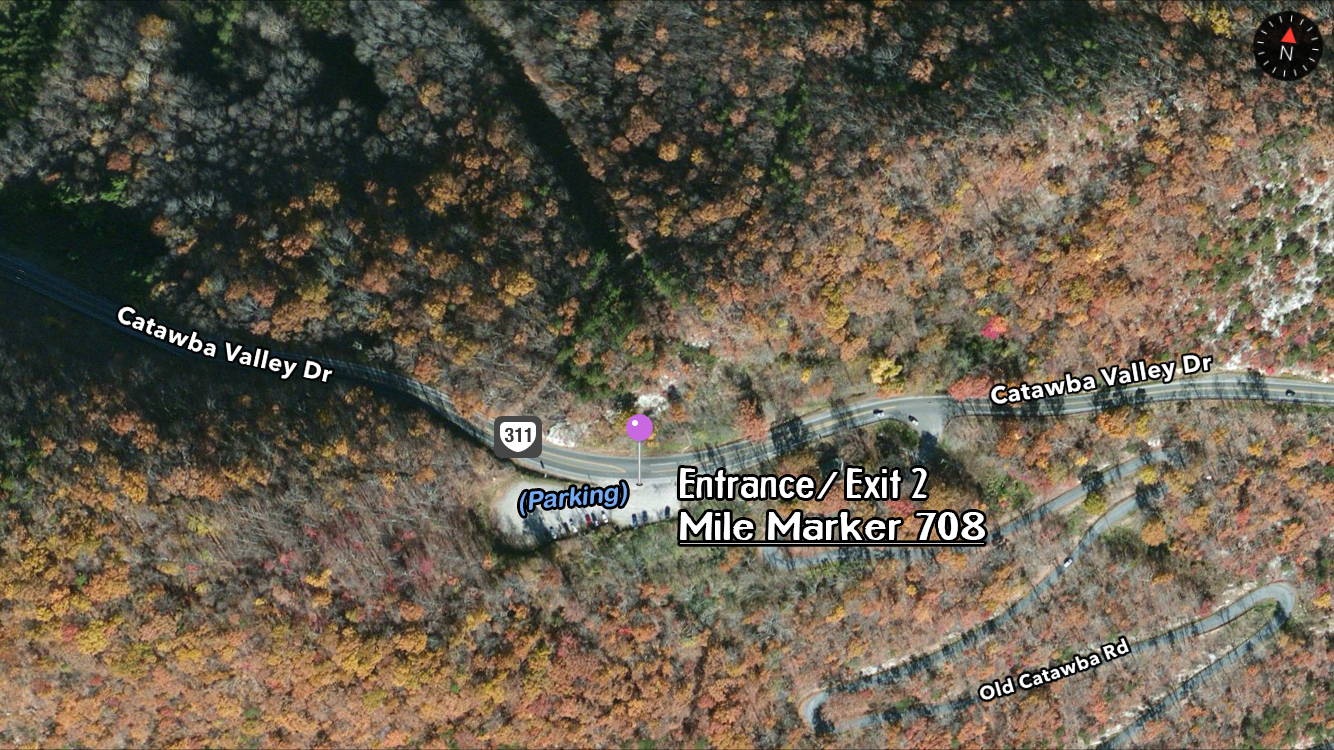
Second Entrance (Parking Available) – Park and enter here for McAfee Knob day hike. Homeplace Restaurant is located 1 mile “trail west.”
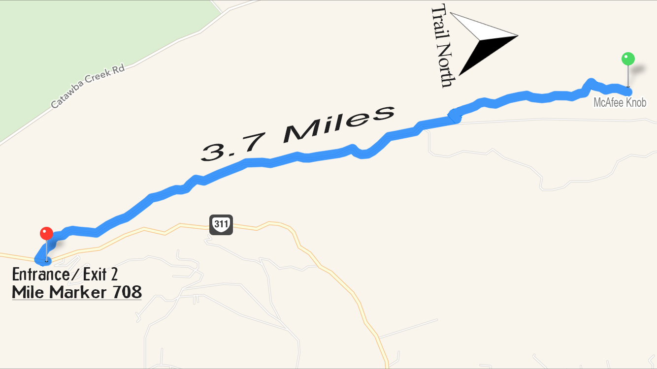
Day hike: Second Entrance highlighting 3.7 mile stretch to McAfee Knob. You could park at the parking area, bring a lunch and eat at McAfee Knob, then return to your vehicle.
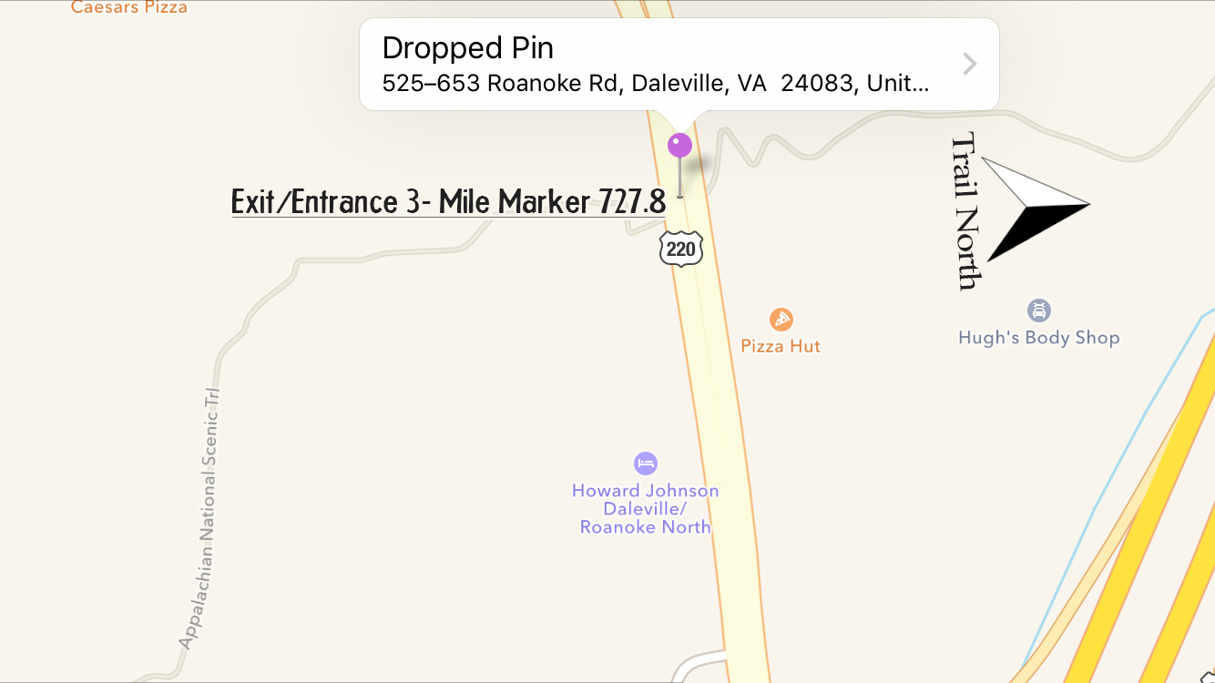
Third Entrance (No Parking directly at trail head) – You can see the Howard Johnson Trail East. It is seen fairly easily from the trail head and is definitely in walking distance. I stayed here during my thru-hike.
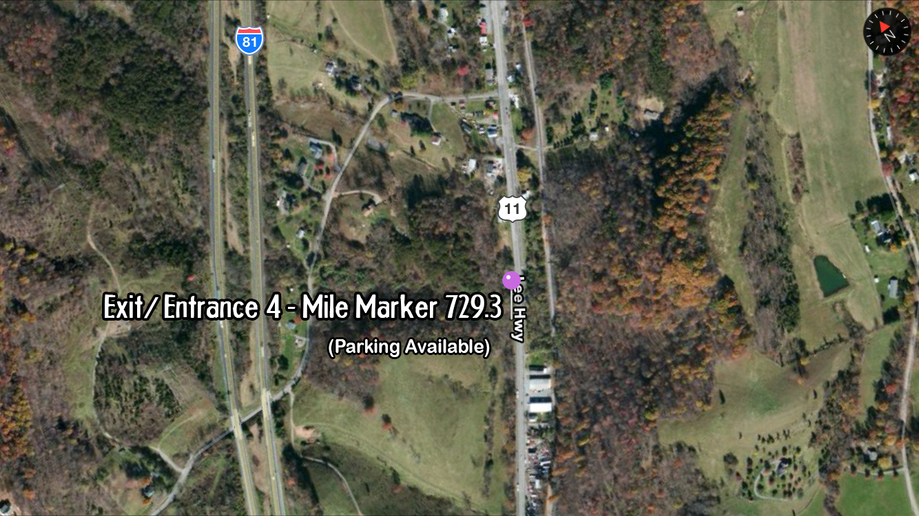
Entrance/Exit 4 (Parking Available near trail head)
- Hostels:
Four Pines Hostel
6164 Newport Rd.
Catawba, VA 24070
(540) 309-8615
https://www.facebook.com/Four-Pines-Hostel-215902991760062/
- Shelters (All sleep 6, have surrounding tenting areas and a privy.)
-Mile 709.0: Johns Spring Shelter (water is unreliable)
-Mile 710.0: Catawba Mountain Shelter (water is unreliable)
-Mile 712.4: Campbell Shelter (reliable water behind shelter)
-Mile 718.4: Lamberts Meadow Shelter (reliable water)
- Sights to see:
-Mile 711.7: McAfee Knob
-Mile 717.3: Tinker Cliffs
- Other Relevant Info:
The Homeplace Restaurant
4968 Catawba Valley Dr
Catawba, Virginia 24070
(540) 384-7252
https://www.facebook.com/The-Homeplace-Restaurant-115564841808913/
- Original Blog Post Covering This Section (during my 2015 thru-hike):


I did this hike from Catawba parking at 311 last Friday and Saturday. Stayed at Campbell Shelter Friday night and hiked to Daleville on Saturday. This was a great recommendation. I drove fourteen hours from SW Missouri to do this. Got hooked on your videos last April 2017 and it inspired me to get out there. Did Standing Bear to Max Patch in July and this jaunt two days ago (Sept 15 – 16). Thank you for the inspiration Dixie. By the way, on the way into Roanoke I noticed signs for Dixie Caverns. Name them for you? LOL 😉
YAYYY! So glad that someone took me up on the suggestion. Impressed that you drove that far for it and really glad you enjoyed it 🙂 Congrats on getting out in nature..beware, it’s addicting. Haha, doubt the caverns were named for me but that’s pretty cool.
What is water like between macafees and tinker cliffs? Just wondering because I hike with a dog.
Plenty of dogs have made it through there! Go for it 🙂
I hiked this last weekend with two other 61 year old college buddies. We parked in Daleville, ate lunch at 3Lil Pigs, and caught an Uber to the Catawba trailhead. Day 1 was rainy and foggy, so the McAfee Knob and Tinker Cliffs views were poor. We were slow and ended up at Tinker Cliffs at dusk, so hiked to Lambert Meadows in the dark and rain. Arrived there about 7:45 pm and found only 1 occupant. Was really happy to have the shelter (and the privy)! Temps were low to mid 40’s. A great hike for 3 old guys!